
Those who believe the world is flat may well struggle with the instruments of science presented on the following pages. The 5th BC discovery that Earth is round provided the foundation for astronomy and from that, the ability to accurately measure time, distance and location.
These examples of navigational instruments were selected for scientific and mathematic innovation, military importance, craftmanship or in the case of those shown first, as miniature works of art.
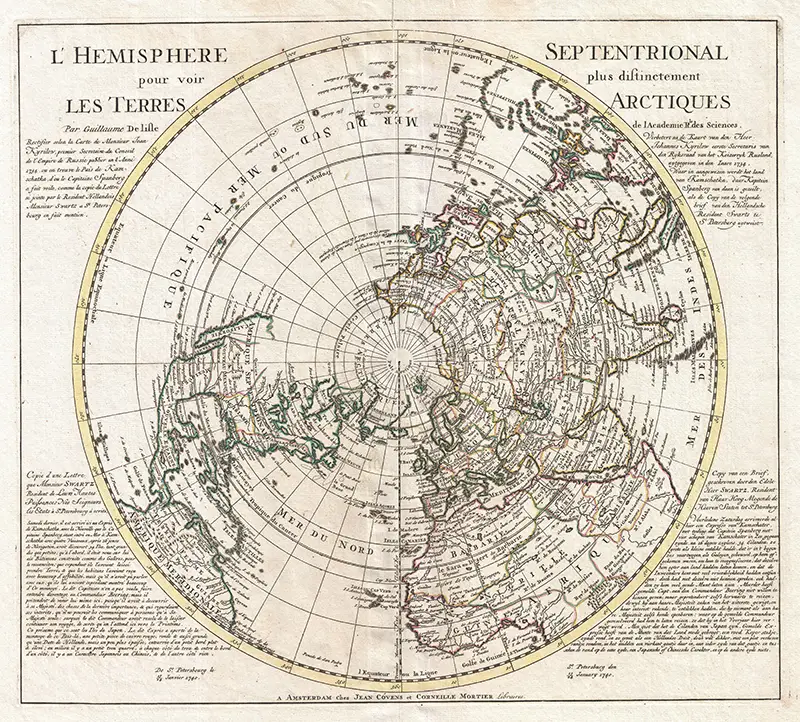
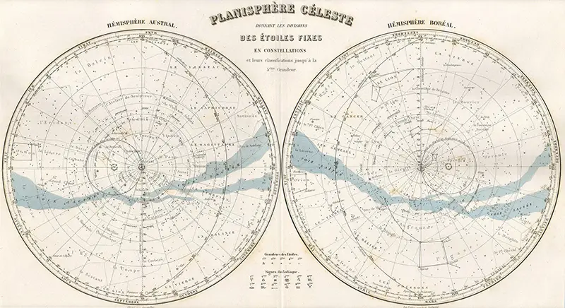
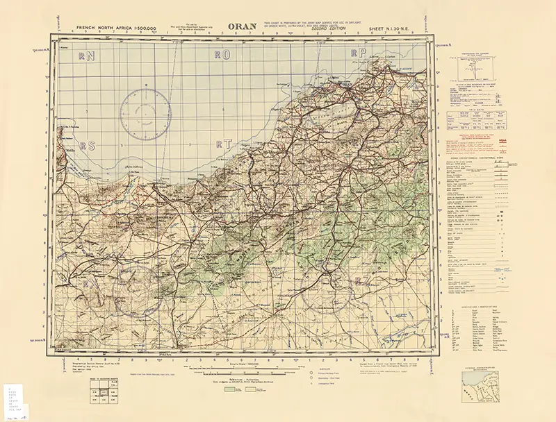
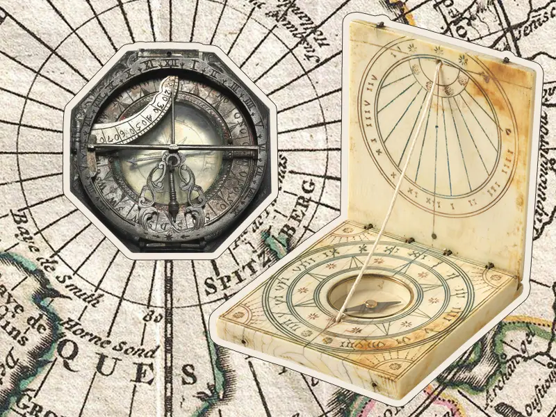
We’ve used some beautiful maps as the backgrounds for the images in this feature. The full, unedited maps are shown at the end of the feature.
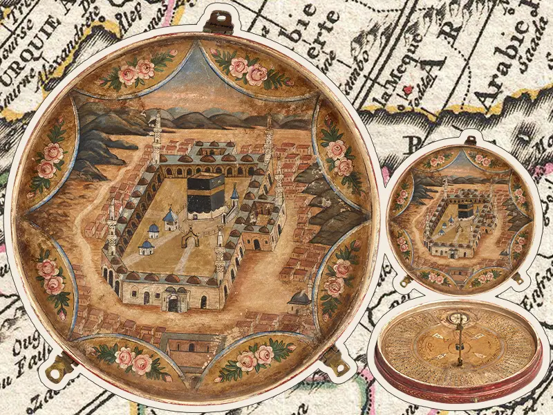
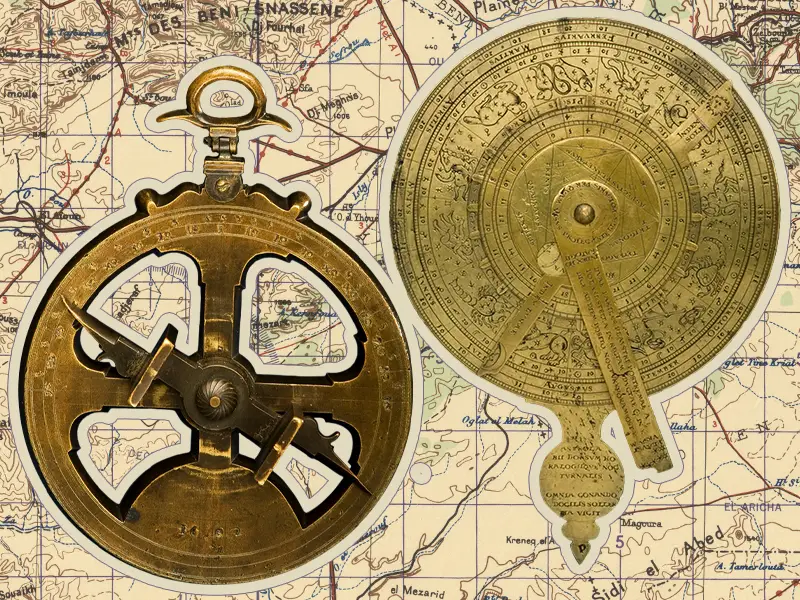
Above: QIBLA COMPASS. This is used to find the direction and time for prayer.
Below: SUNDIAL COMPASS. The compass is used to find north in order to use the sun to tell the time.
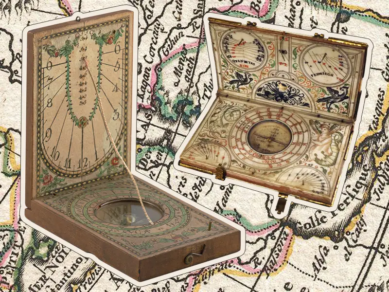
Right: 1600. Historical Museum of Bern (Rama 33040 CC BY-SA 3.0 FR)
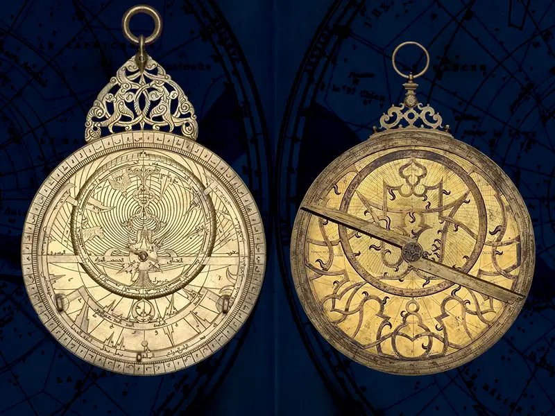
Right: 1500-1525. Rijksmuseum.
The astrolabe is the antique equivalent of the pocket calculator and multi-tool. Its name traces back to two Greek words; áστρον: astron star, and λαμβάνειν: lambanein to take.
As the name suggests, the astrolabe dates back to ancient Greece, but it was developed into its finished form in the medieval Islamic world by Muslim astronomers and mathematicians, making its way to the western world via Islamic Spain.
One of the significant texts about the astrolabe was written by none other than poet Geoffrey Chaucer in 1391. His Treatise (based upon a Latin translation of an earlier text by Persian astrologer Mashallah), is considered to be the first scientific manual (on any subject) in the English language. Part of it details around 40 of the things that an astrolabe could do, a fraction of the 1000+ uses listed in some other texts.
Among its many uses, an astrolabe could be used to precisely determine date, time and direction, making it an important and useful tool for scheduling Islamic prayers.
It was relied upon for over seven centuries, eventually being succeeded by the sextant in the 1700s.
Consider how easy it is to glance at the time on your watch, or orientate yourself with Google Maps on your phone. The astrolabe is certainly slow in comparison, but as highlighted by author Tom Wujec in his 2009 Ted Talk (quoted below), using an astrolabe gives its holder a sense of their connection to the world.
“Knowing the sky, knowing your relationship with the sky, is the centre of the real answer to knowing what time it is.”
Tom Wujec
Astrolabes were made from wood or paper, but it is mostly the more resilient and precise brass examples which survive today, some of which are pictured overleaf. Their range sizes from palm-sized to the size shown here on the left.
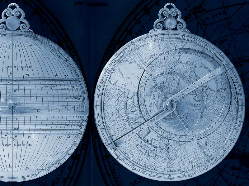
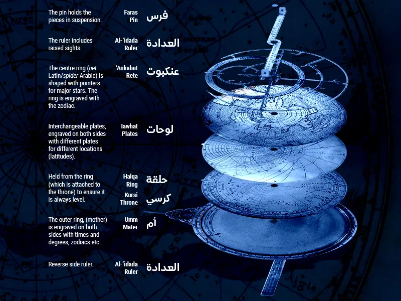
Here is an attempt to explain how an astrolabe is used to calculate the time of day. Or, you can follow this link to a 2 min PBS video on YouTube which explains it far better!
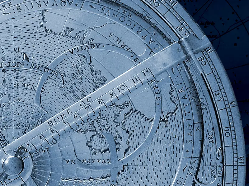
Using the correct plate for your location (latitude), hold the astrolabe upright. By day, rotate the ruler until the sun shines through both holes. The ruler now points to an altitude reading on the outer wheel. Turn the astrolabe over and find the concentric circle that corresponds to the altitude reading, and the date on the rete. Rotate the rete until the date and circle overlap. Now, you are able to follow a line from the centre pin, through the date, to the outer ring, where the correct time will be displayed.
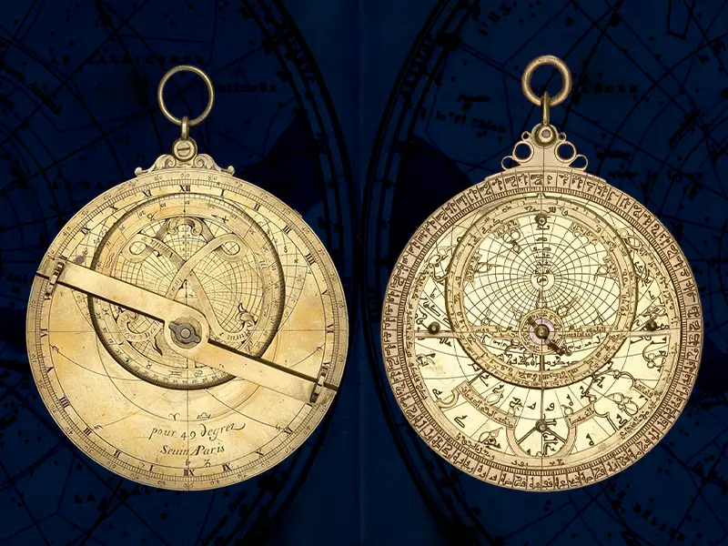
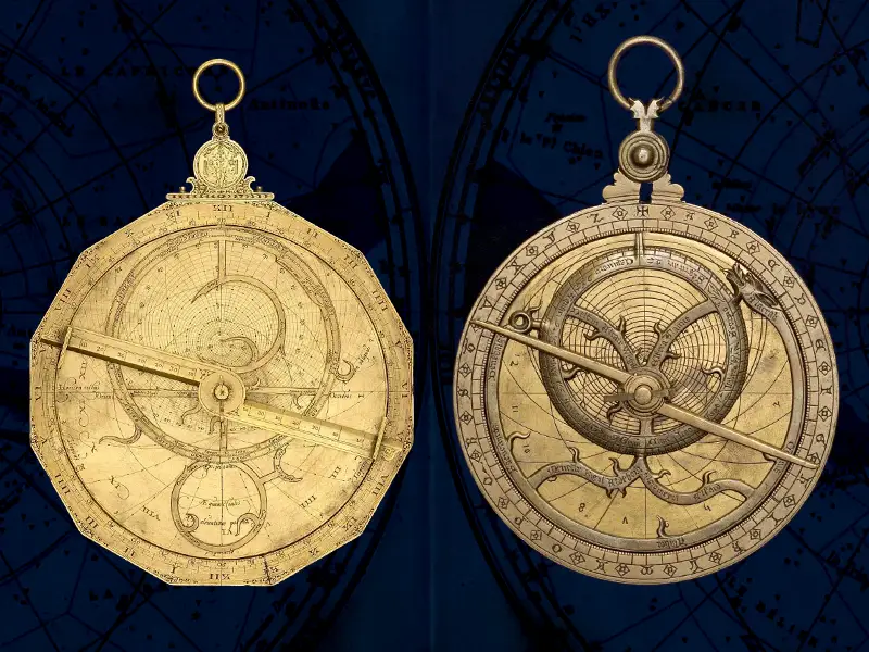
The following astrolabes are held by History of Science Museum, Oxford and were made available digitally by the Wikimedian in Residence under the CC BY-SA 4.0 licence. For more information visit www.mhs.ox.ac.uk and search their astrolabe catalogue by the inventory number.
The captions state the year, maker, place and inventory number.
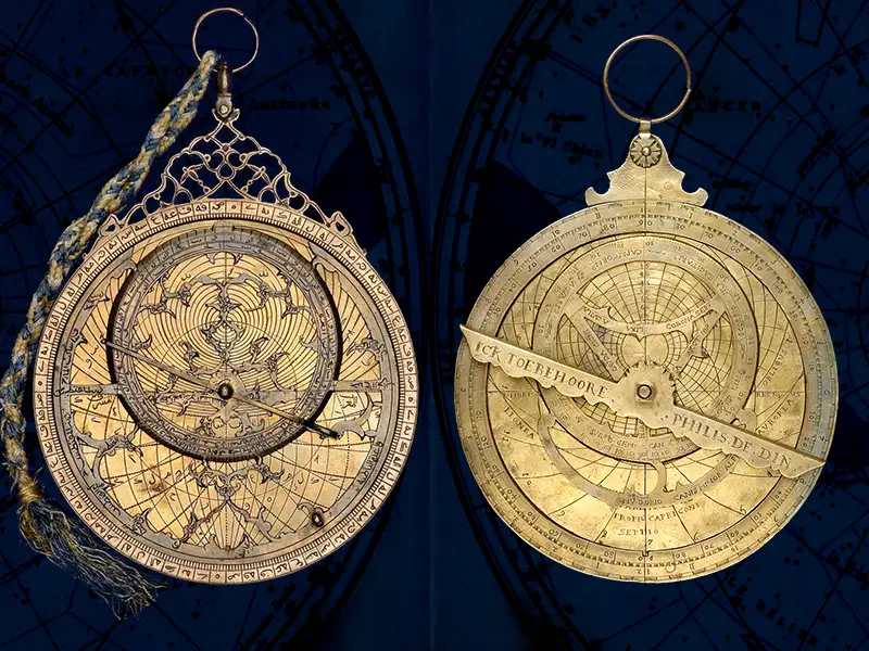
Right: 1595 / Unknown / Paris (?) / 45975
Right: 1081/2 / Muḥammad ibn Sa‘īd as-Ṣabbān / Guadalajara / 52473
Right: ca. 1370 / Unknown / England (?) / 47869
Right: Late 16th C / Unknown / Flanders / 45365
Above left: MARINER’S ASTROLABE. A simplified version of the astrolabe for use at sea, which could only measure latitude. With cutouts to reduce wind resistance.
Above right: VOPEL COMPENDIUM. A 16th century German invention which uses an astronomical diagram and geometrics to measure time by day or night.
Below right: SEXTANT. Used at sea to calculate a ship’s position. Used vertically, it measures the angle between a celestial object and the horizon. Used horizontally, it measures the angle between two landmarks. 1870-89.
Below left: SUN COMPASS (BUMSTEAD). This sun compass was designed by cartographer Albert H. Bumstead for a 1925 Arctic expedition, to solve the problem of magnetic compasses not working in the North/South Pole. It instead tracks the movement of the sun across the sky to set the compass dial.
Below: PHOTO. US Merchant Navy Captain uses sextant, ca 1960s.
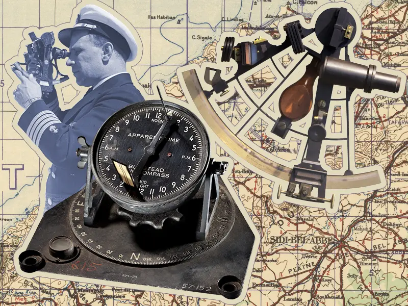
Sun compass: Smithsonian
Photo: Auckland War Memorial Museum
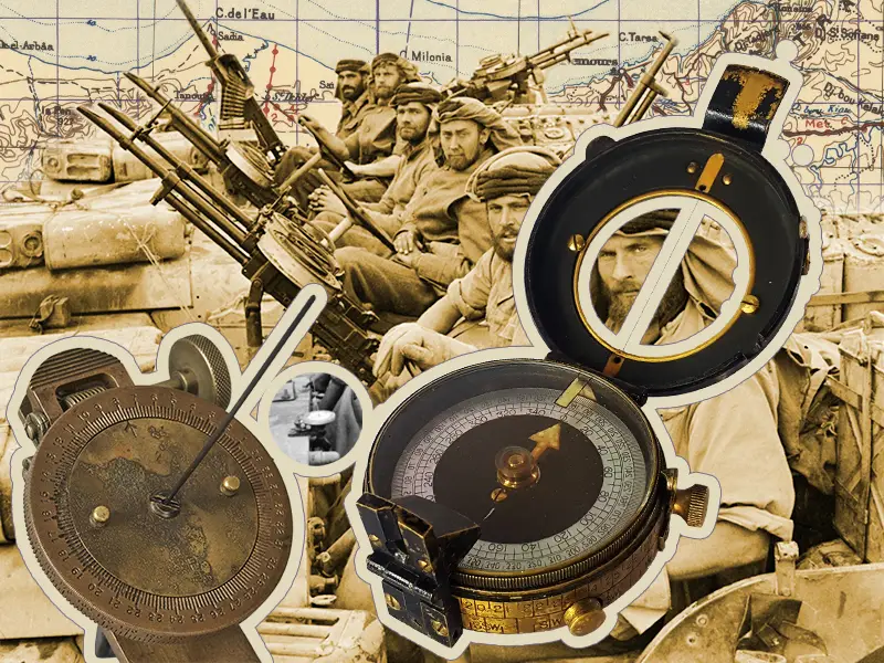
Photo: Keating (Capt) No 1 Army Film & Photographic Unit
Verners compass: Used in WWII by Corporal Sydney Frank Wheeler
Above left: SUN COMPASS (BAGNOLD). This sun compass was designed by Royal Engineers officer Major Ralph Bagnold having found the need in the North African desert for a compass that could still work reliably while mounted to a vehicle (which interrupted the magnetics) and not be affected by the iron ore deposits present in the region. Unlike other sun compasses used by the Army, it allowed vehicles to deviate from their set course without having to reset the compass. The compass was used by Bagnold’s LRDG group and the SAS in WWII (highlighted in the background photo).
Above: PHOTO. Members of “L” Detachment, Special Air Service n North Africa, January 1943.
Above right: COMPASS (VERNERS PATTERN MKVII). A prismatic compass invented in the 1890s. Noted for its ease of use, it was named for soldier and ornithologist Colonel William W C Verner, who had a number of patents to his name including for improvements to military sketching boards and clinometers. It was mass-produced throughout WWI and those manufactured then were still in use by soldiers during WWII.
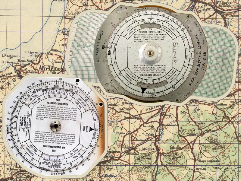
Below: 13&14 E-6B (right) / MARK 8 FLIGHT COMPUTER (left). The E-6B was developed in the late 1930s (named for its part number) by the US military. It went into mass production following the attack on Pearl Harbour and it still used in flight exams today. Similar, is the Mark 8, used in the late 1940s. Plastic versions (of either computer) would glow in the dark to aid night navigation.
Below are the maps used in the backgrounds of this feature’s images. Click the source links to see them full size!